
Site plan vs survey is one of the most common questions people ask before applying for a building permit, because the two documents look alike: both show your lot from above with lines and numbers. They do very different jobs. A site plan shows the permit office where your project will go. A survey proves where your property lines are. Ordering the wrong one costs time, money, or both.
Quick answer: A site plan is a scaled drawing of your lot and the work you plan, usually drafted from records, and it is enough for most residential permits. A boundary survey is a field measurement by a licensed land surveyor that legally establishes your lot lines. You need a survey when the permit office, lender or title company requires one, or when work is close to an uncertain line.
Key takeaways
- Site plans show the project; surveys establish the boundary.
- Only a licensed land surveyor can prepare a boundary survey.
- Most decks, fences, sheds and pools need a site plan, not a new survey.
- An existing survey or plat is the best source for drafting a site plan.
- In California, any plan that locates property lines must come from a surveyor.
What is a site plan?
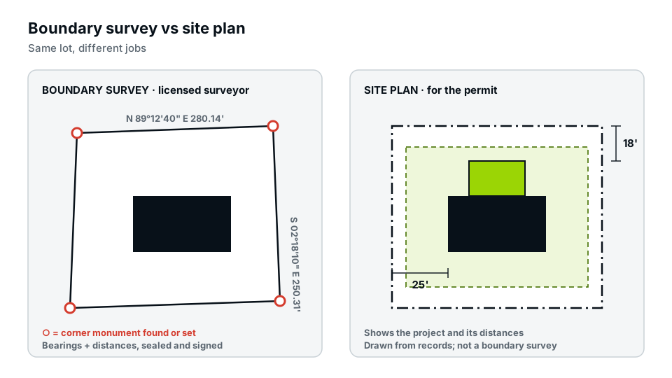
A site plan is a top-down drawing of a property, drawn to scale, that shows the lot lines, existing buildings and the proposed work, with the distances between them. It answers the question “where will this go?” so a reviewer can check setbacks, lot coverage and easements. Site plans are prepared by drafters, designers, architects, engineers or sometimes the homeowner, and they are usually based on existing records rather than a new field measurement. For a fuller explanation, see our guide on what a site plan is.
What is a boundary survey?
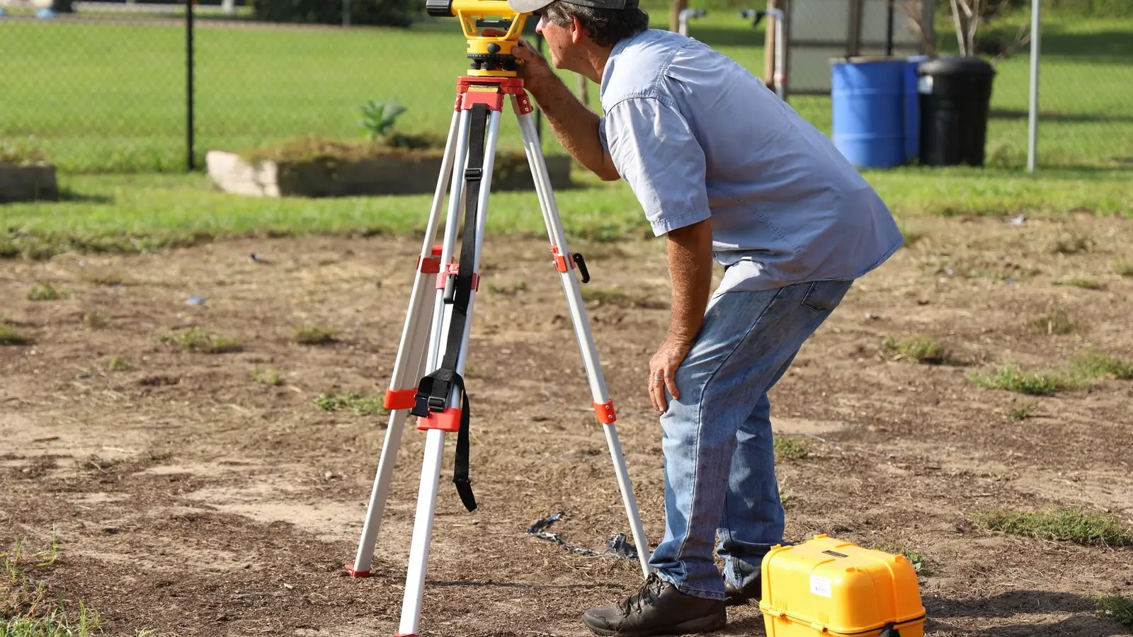
A boundary survey is a professional measurement of a property’s legal boundaries. A licensed land surveyor researches the deed, plat and neighbouring records, goes to the property with precision instruments, finds or sets the corner markers, and produces a sealed drawing showing the lines with their bearings and distances. Because it is sealed by a licensed professional, a survey can be relied on in disputes, sales and lending.
A boundary survey is one of several survey types. Others measure elevations, locate improvements for a lender or document finished construction; our guide to the types of land surveys explains each.
Site plan vs survey: side by side
| Site plan | Boundary survey | |
|---|---|---|
| Main purpose | Show the project to the permit office | Establish the legal boundary |
| Prepared by | Drafter, designer, architect, engineer or owner | Licensed land surveyor only |
| Site visit | Not usually | Yes, field measured |
| Corner markers found or set | No | Yes |
| Professional seal | Usually not required | Yes |
| Shows the proposed work | Yes, that is the point | Only if specifically requested |
| Typical time | Days | Often weeks, depending on the surveyor’s schedule |
| Can settle a boundary dispute | No | Yes |
When is a site plan enough?
For most residential permits, a site plan drafted from good records is what the permit office asks for. It is usually enough when:
- The checklist says “site plan” or “plot plan”, not “survey”.
- The project is well inside the setbacks, so a small uncertainty in the boundary would not change the answer.
- You already have a survey or recorded plat that the plan can be drawn from.
- The project is a deck, fence, shed, pool, driveway, patio, solar array or modest addition.
Many counties explicitly accept a site plan drawn on a copy of an existing survey, which is often the cheapest compliant option.
When do you need a survey instead?
A new boundary survey becomes necessary in a handful of situations:
- The permit office requires one. Some jurisdictions ask for a survey for new homes, additions or any work near a property line.
- The work is close to the line. If a garage will sit within a foot or two of the minimum setback, the exact line matters.
- The boundary is uncertain or disputed. Old fences in the wrong place, missing corner markers or a disagreement with a neighbour.
- A lender, title company or buyer asks for one. This is common in purchases and refinancing.
- You are splitting or adjusting a lot. Recorded plats and lot line changes require a surveyor.
- Your state requires it. In California, locating property lines is legally land surveying, so a surveyor must prepare the plan.
Can you use an old survey for a site plan?
Usually yes. An existing survey, even one from years ago, is the most accurate starting point for a site plan, provided the lot has not been split, combined or re-platted since and the corner markers have not been disturbed. The site plan simply adds the current buildings and the proposed work to the surveyed boundary, and notes the survey date as its source. Some permit offices want the survey attached; a few require one less than a certain age. Our guide on using an old survey for a permit covers the details.
How to find your property lines
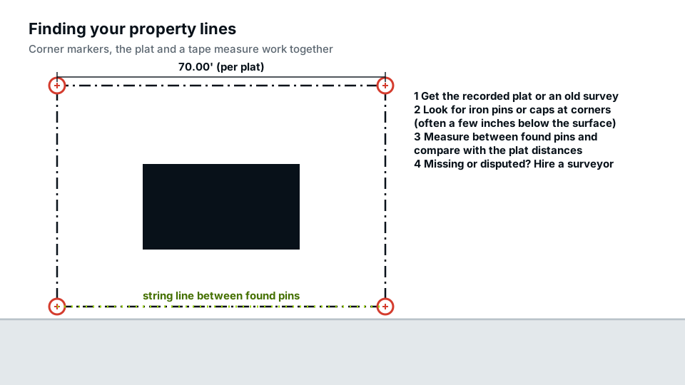
Before deciding between a site plan and a survey, it helps to know what you already have. Start with your closing papers, which often include a survey or plat. Look up the recorded plat at the county recorder. Then walk the lot looking for corner markers, usually iron rods or pipes, sometimes with a plastic cap stamped with the surveyor’s licence number. If you find all four and they match the plat, a site plan drawn from the plat is likely fine. Our guide on how to find your property lines walks through each step.
Mortgage surveys and other look-alikes
Not every drawing called a survey is a boundary survey. In some states, lenders accept a “mortgage survey”, “location survey” or “mortgage inspection plan” that shows the house on the lot but does not set corner markers or guarantee the boundary. These documents are useful sources for a site plan, but many carry a note saying they must not be used to build fences or other improvements. Our comparison of a mortgage survey vs boundary survey explains the difference.
How the choice affects cost and timing
A drafted site plan is quicker and cheaper because it reuses existing data and needs no field crew. A boundary survey takes longer because the surveyor must research records, schedule a field visit, measure, set or verify markers and prepare a sealed drawing. Field survey prices vary a lot with lot size, terrain, vegetation, records quality and region.
The practical approach most homeowners take is:
- Read the permit checklist and note the exact word it uses.
- Gather any survey, plat or closing documents you already have.
- If a site plan is allowed and your project is comfortably inside the setbacks, order or draw the site plan.
- If the checklist says survey, the work is close to a line, or the boundary is in doubt, hire a surveyor.
If you are unsure which applies, our site plan service checks your county’s requirement before quoting, and tells you if a survey is needed instead.
Four real-world scenarios
The rules are easier to apply with examples. These are typical situations, with the document that usually fits:
| Situation | Usually needed | Why |
|---|---|---|
| A 12 × 16 ft deck behind a house on a suburban lot, 30 ft from the rear line where 20 ft is required | Site plan | A 10 ft margin means a small boundary uncertainty can’t change the answer |
| A detached garage planned 5 ft from a side line where 5 ft is the minimum | Survey (or survey-based site plan) | Zero margin: the true line decides whether the garage complies |
| A privacy fence on the line between two neighbours who disagree about where it is | Boundary survey | Only a surveyor can establish the disputed line |
| A pool in a large backyard, with an old survey from the purchase | Site plan drawn on the old survey | The survey gives the boundary; the site plan adds the pool and barrier |
Notice the pattern: the closer the work is to a limit, and the less certain the boundary, the stronger the case for a survey.
What each one needs from you
Whichever you order, having the right information ready shortens the process.
For a site plan, the drafter needs the property address or parcel number, a description of the project with its rough size and position, and any survey, plat or closing documents you have. Photos of the yard help show sheds, patios and trees that aerial images may miss. Your county’s checklist, if you have it, tells the drafter exactly what to include.
For a boundary survey, the surveyor needs your deed, any previous survey and the plat, plus access to the whole property, including corners that may be behind fences or vegetation. Let them know about any known disputes, missing markers or planned construction, so they can locate the features that matter for your project.
The California exception
California’s Business and Professions Code §8726 defines locating property lines as part of land surveying, which only licensed land surveyors (and civil engineers licensed before 1982) may practise. A permit site plan that shows property lines in California therefore needs to come from a surveyor. Elsewhere in the U.S., drafted site plans are the normal route for residential permits. Our California page explains what to do instead.
Common mistakes when choosing
- Ordering a survey when a site plan was enough, and waiting weeks for a drawing that still does not show the project.
- Submitting a survey without the project on it. A survey alone does not show what you plan to build.
- Treating a mortgage survey as a boundary survey and building a fence from it.
- Relying on GIS parcel lines for work right at a setback, where a small error can push the project over the line.
- Assuming the old fence marks the line. Fences are often built inside, or over, the true boundary.
Frequently asked questions
Can a site plan replace a survey for a permit?
Only when the permit office accepts a site plan. If the checklist or reviewer specifically asks for a survey, a drafted site plan will not be accepted in its place.
Do I need a new survey to build a deck or fence?
Usually not. Most counties accept a site plan for decks and fences. A survey becomes worthwhile when the work is close to a line or the line itself is uncertain.
Is a plat the same as a survey?
A recorded subdivision plat is prepared by a surveyor and shows the lots as created, but it is not a survey of your property as it exists today. It is an excellent source for a site plan.
How accurate is a site plan drawn from county GIS data?
GIS parcel maps are approximate and can be off by several feet. They are fine for projects well inside the setbacks, but not for work right at the limit.
Who can prepare a site plan?
In most states, a drafter, designer, architect, engineer or the homeowner. In California, a site plan that locates property lines must be prepared by a licensed land surveyor.
Should I get a survey before buying a house?
It is often worth it, especially if you plan a fence, addition or pool, or if fences and driveways look close to the lines. A boundary survey before closing can reveal encroachments while you can still negotiate, rather than after you own the problem.
Can a surveyor also draw my site plan?
Yes. Many surveyors offer a plot plan or site plan that adds your project to their survey. That combination is common for new homes and for work near property lines.