
A GIS parcel map is your county or city’s online map of every property, with layers for zoning, flood zones, aerial photos and more. It is free, it is usually the fastest way to answer basic questions about a lot, and it is where most permit research should start. It also has limits that matter when your project is close to a property line.
Quick answer: Search your address on the county or city GIS viewer, click your parcel, and read the parcel record for its ID, size and owner. Then turn on the zoning, flood zone, aerial and contour layers. Use it to find your zoning district and constraints, but don’t treat the parcel lines as a survey: they can be several feet off.
What a GIS parcel map is
GIS stands for geographic information system: software that stacks map layers on top of each other. Local governments use it to manage property, zoning, utilities and planning, and most publish a public viewer. The parcel layer outlines each lot and links to a record with details from the assessor. Our pillar guide on how to find your property zoning explains how this fits into permit research.
How to find your county’s GIS viewer
- Search for “[your county] GIS parcel viewer” or “[your city] zoning map”.
- Look for an official government domain, usually ending in .gov or .us.
- If the county has no viewer, try the property appraiser or assessor’s website, which often has its own map.
- Some states run statewide parcel viewers that link to county data.
The parcel record: what each field means
| Field | Meaning |
|---|---|
| Parcel ID / APN / PIN | The unique number for your lot; use it on permit forms |
| Owner and mailing address | As recorded for tax purposes |
| Site address | The physical address of the parcel |
| Acreage or square feet | Lot size from records, sometimes calculated from the map |
| Legal description | Lot and block or metes-and-bounds description |
| Subdivision and plat reference | Where to find the recorded plat |
| Land use code | The assessor’s use category, not the same as zoning |
| Year built, building area | Assessor data, useful but not always current |
Note the difference between the assessor’s “land use code” and the planning department’s “zoning”. They are separate systems, and only zoning controls what you may build.
The layers to turn on in a GIS parcel map
- Zoning: your district code, such as R-1.
- Overlays: historic, airport, environmental or special districts.
- Flood zones: FEMA flood hazard areas, often from the National Flood Hazard Layer.
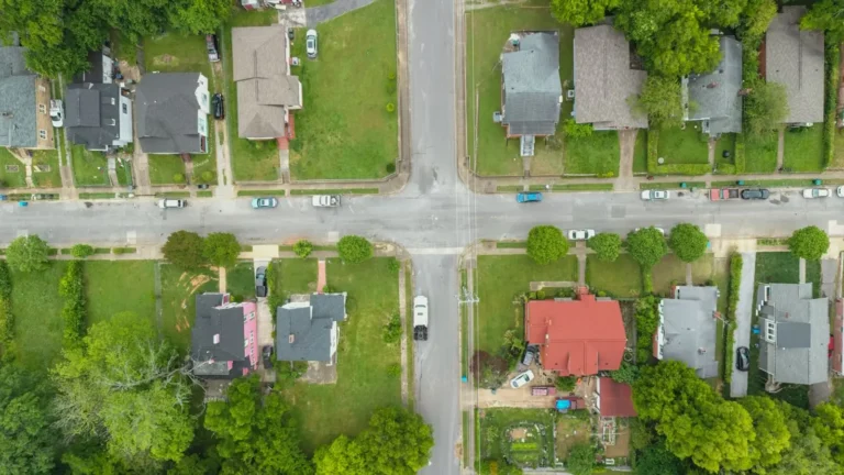
- Aerial imagery: recent photos showing buildings, driveways and trees.
- Contours or elevation: how the ground slopes.
- Easements and right-of-way: where available, though many counties don’t map easements.
- Utilities: water, sewer or septic data in some counties.
- City limits: to confirm whether city or county rules apply.
Where GIS parcel lines are not accurate enough
Parcel layers are drawn from deeds, plats and old maps, then fitted onto aerial photos. They are excellent for identifying a lot and its shape, but their position on the ground can be shifted, sometimes by several feet, especially in older neighbourhoods and rural areas. You will often see parcel lines that cut through buildings on the aerial photo. That is a mapping offset, not an encroachment.
For permits, this means GIS is fine for projects comfortably inside the setbacks. When work is close to a line, use a recorded plat or a survey instead. Our guide on site plan vs survey explains when that becomes necessary.
Measuring on a GIS map
Most viewers have a measure tool for distances and areas. It is useful for estimates, such as a rough lot coverage figure or the distance from a house to the street, but treat the results as approximate. Aerial photos are taken at an angle and roof overhangs hide wall positions, so a building footprint measured from imagery is often a little larger than the true foundation. Our guide to lot coverage shows how to calculate it properly.
Using GIS data for your site plan
A drafted site plan often starts with the GIS parcel outline, then corrects it using the plat or survey dimensions and places buildings from aerial imagery and your measurements. A good plan names its sources in the title block, so the reviewer knows what the lines are based on. Our site plans state the source of the boundary on every sheet.
Common mistakes reading a GIS parcel map
- Treating the parcel line as the legal boundary.
- Confusing the assessor’s land use code with zoning.
- Missing an overlay because its layer was turned off.
- Relying on old aerial imagery that predates recent construction.
- Using the wrong viewer, city instead of county or vice versa.
Other free property data sources
The county GIS viewer is the main tool, but a few others fill in the gaps. The recorded plat, usually available through the county recorder or register of deeds, gives dimensioned lot lines and platted easements. FEMA’s Flood Map Service Center provides the official flood map panel for your address. Street-level imagery helps confirm fence lines, driveways and building features that aerial photos hide. And many cities publish permit history search tools, which show what has been built and approved on the lot before.
When to go beyond the GIS map
Use the GIS viewer to get oriented, then confirm the important details at the source: the recorded plat for dimensions and easements, the zoning code text for the actual rules, FEMA’s Flood Map Service Center for the official flood zone, and a surveyor when the line itself is in question.
Frequently asked questions
Are GIS parcel maps accurate?
They are good for identifying parcels and approximate shapes, but lines can be shifted several feet from their true position. They are not a substitute for a survey.
Why does the parcel line go through my house on the map?
Usually because the parcel layer and the aerial photo are slightly misaligned. It rarely means the house is over the line, but a survey would confirm.
Does the GIS map show easements?
Some counties map easements; many don’t. Check your recorded plat and title documents for a complete list.
Can I use a GIS screenshot as my site plan?
Usually not. Screenshots lack a reliable scale, dimensions and the proposed work. Many offices accept GIS data as a source for a proper scaled site plan.
Is GIS data free?
Public viewers are typically free. Some counties charge for downloading data files or certified copies.